What is an Unmanned Aerial Vehicle (UAV)?
The UAV was used for a variety of military purposes before its commercial revolution in the 2010s. In order to keep up with fast-changing, advancing technology, and the widespread popularity and purchase of these devices for recreational use, the Federal Aviation Administration (FAA) implemented drone licensing and registration. Under FFA regulations, all recreational fliers and commercial operators must register their aircraft, but only commercial operators must obtain a license. McClure’s Josh Doughan, Survey Team Leader, Scott Corwine, Project Manager, Timothy Devaney, Survey Crew Chief, and Kyle Younkin, Staff Engineer, have obtained their remote pilots’ certification.
The small UAV used to be considered solely as a recreational flying toy, but its functionality is much more intricate. This flying machine was not only originally used for surveillance, but also surveying and mapping, and its original functions have become vital in the engineering field.
The UAV in the Engineering Field:
During a short turnaround period, UAVs are especially crucial for conducting a quick and efficient survey, for physical surveying is much more time-consuming. Flying a UAV can also be safer than performing a physical survey. Accessing and surveying a site is potentially dangerous if the equipment is running, construction and rock piles are present, or cars are in close contact with the crew. Use of the UAV creates access to surveying site conditions without putting oneself or anyone else in danger.
In Action
For a project on a wastewater treatment plant, the contractor contacted McClure at 7 AM needing a topographical survey so they could start grading. In the past, surveyors would have a difficult time quickly surveying an active, muddy construction site with equipment running such as this one. Thanks to the UAV, the site could be captured with minimal hindrance to the contractor and danger to the surveyor.
McClure’s UAVs:
DJI Phantom 4 Pro: The most frequently used UAV worldwide for commercial flights. The Phantom is a quadcopter with four propellers that simultaneously control lift and maneuvering. It can fly for about 20 minutes per battery and is able to fly in both automated and manual flight modes. This UAV is useful for taking images at every angle of a structure and navigating through tight urban environments on sites less than 40 acres.
senseFly eBee Plus: This fixed-wing UAV flies like your typical airplane and is used for large surveying projects. It goes faster than the DJI Phantom 4 Pro, has a higher resolution camera, and can fly for longer periods of time with about an hour of battery time. This UAV does not have a manual controller but uses flight planning software to autonomously control the flight path. The pilot defines the project extents, the resolution of the imagery, and the percentage the photos should overlap; the UAV does the rest. This drone is also programmed to know where to land and take off. Real-time kinematic GPS on the eBee utilizes the real-time network (RTN) and produces images with less than 0.1’ geolocation. The eBee is best used in suburban or rural areas that are relatively open and performs at its best for areas between 40 and 2000 acres.
McClure and the UAV:
The McClure UAVs use a single camera to capture topographical data. Using a process called photogrammetry, the georeferenced images are virtually “stitched” together and the position of the objects on the ground are triangulated from the pixels in the image. A point cloud is created that can contain up to several billion points to define the site surface. With photogrammetric reconstruction, the UAV works best surveying wide, open sites, bare earth, and hard surfaces, some objects, and land types aren’t conducive to creating an accurate surface, such as tall grass and water.
McClure has flown over 50 missions over 7,200 acres in the last two years, with its largest project in terms of length being the Plywood Trail between Sioux City and Le Mars–a road corridor 19.5 miles long. By area, the largest site McClure has flown is the Big Cedar Logistics Park in Cedar Rapids, Iowa, consisting of 1,700 acres. The logistics park flight took two days to fly and captured 10,800 images and took a week to process.
High-Resolution Site Maps:
McClure’s pilots use UAV’s for updated aerial maps and images of project sites. On new development sites, updated georeferenced aerial images are needed so the team can locate new structures, roads, and other site features. While a full survey of the site is required to accurately access where land alterations and additions have been made, the high-resolution maps are compared to points collected in the field to make sure the survey is correct and complete.
In Action
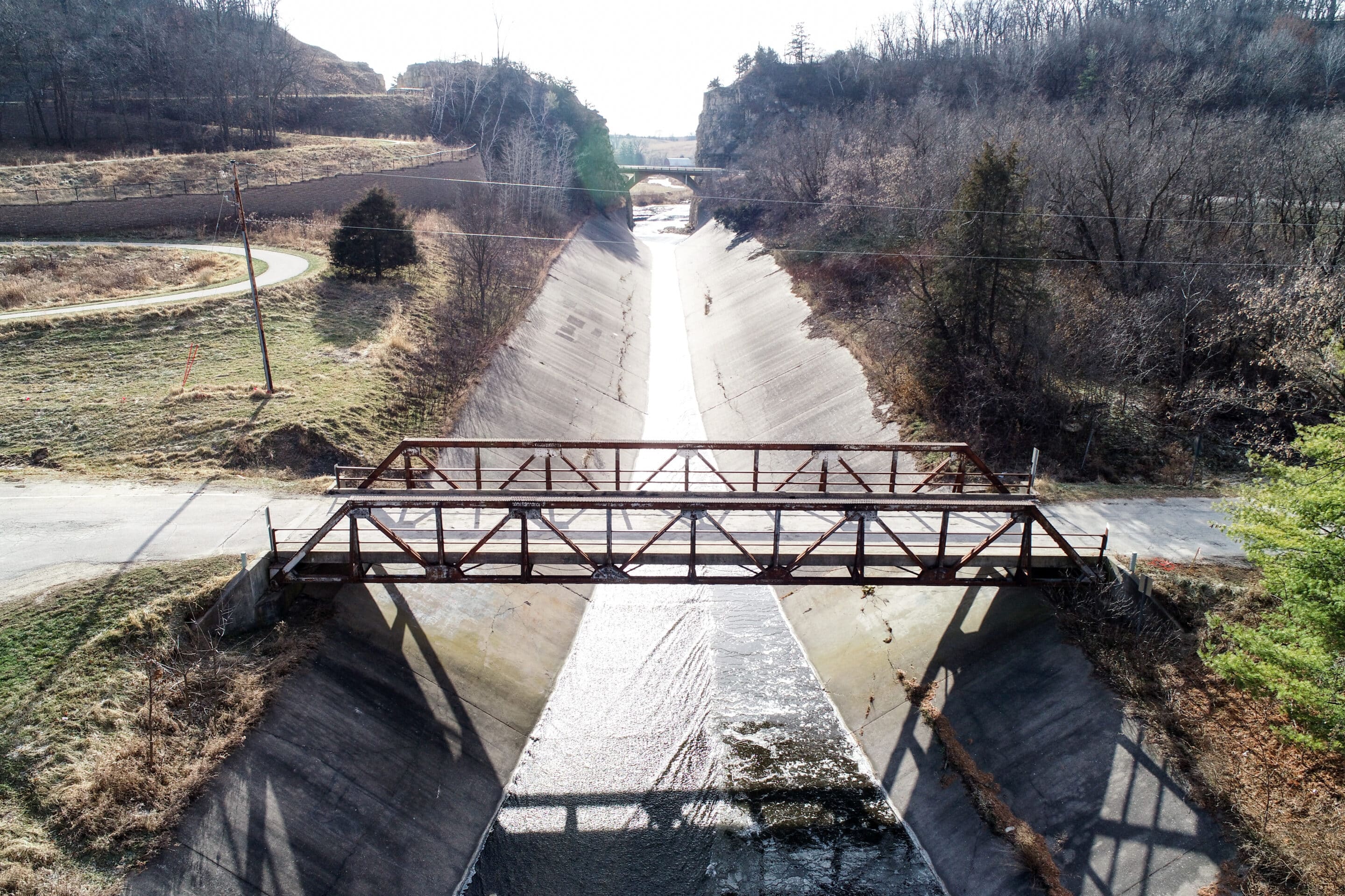
The usability of these images proved to be incredibly useful during a November flight over of a bridge and concrete channel in Decorah, Iowa. Upon reviewing the high-resolution aerial imagery, McClure spotted easily-recognizable cracks in the channel and quickly estimated the cost of repair. The position of gate posts was also needed for project progression and instead of performing a lengthy survey, the team simply marked the points in the georeferenced images.
Topographical Surveying:
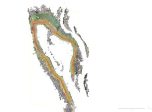
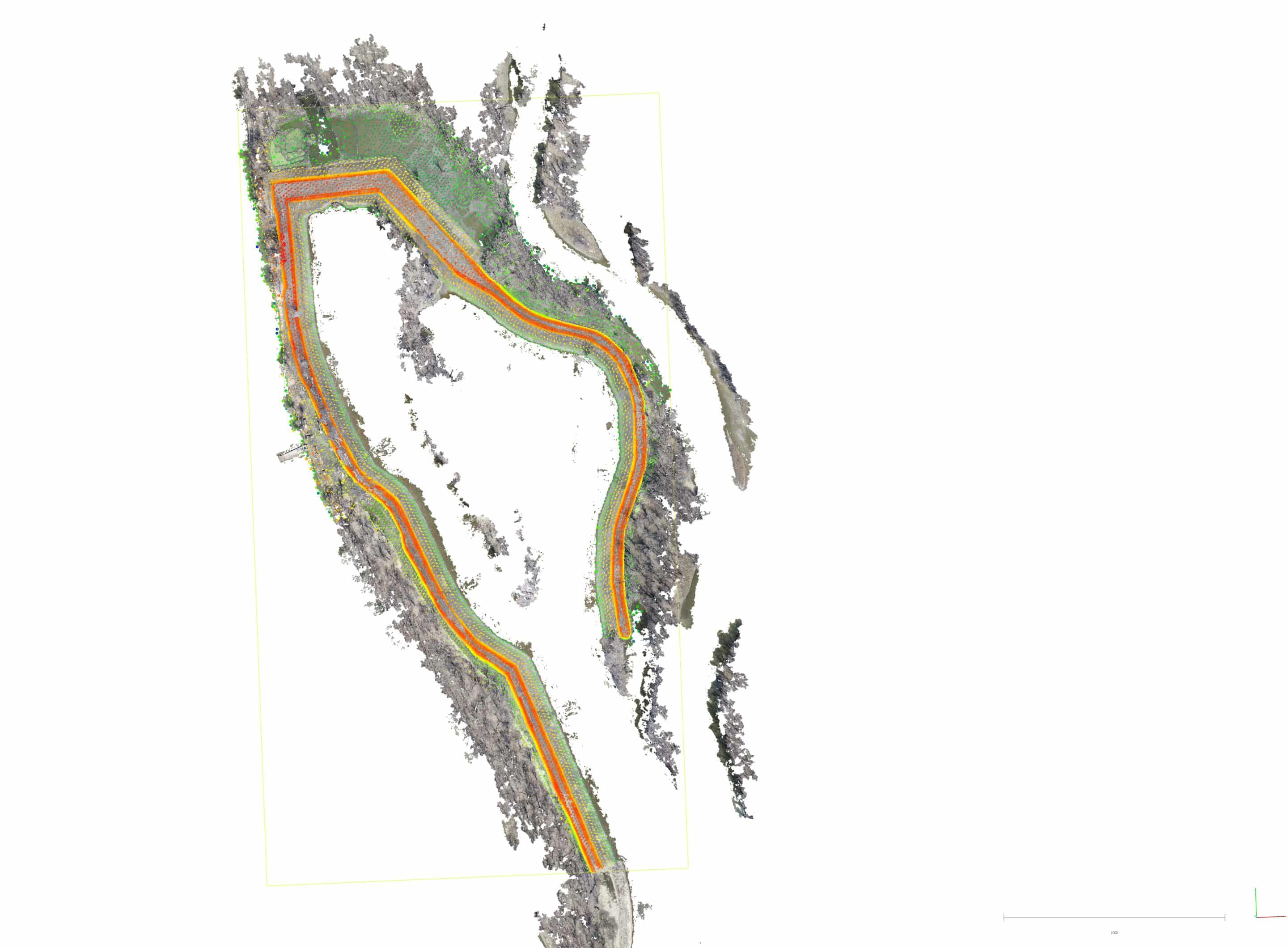
For topographical surveys, the elevation and a 3D surface of the project site must be determined in order to plan the height of construction for roads and where drainage needs to be placed. Surveying an area of several hundred acres can be completed in a matter of hours using our UAVs.
In Action
On one site for the Army Corp of Engineers, it took four survey crew members three days to capture existing site conditions of an island on the Mississippi River. McClure brought in the Phantom 4 Pro after the site was graded and flew the same area in four hours with one pilot to determine the volume of earthwork that was moved by the contractor.
McClure’s UAVs by the Numbers:
- Google Earth aerial images normally have a resolution of 15 cm. (6 inches) per pixel, and the UAV captures imagery from 1.1 to 0.4 inches per pixel. Therefore, UAV aerials are 15 times more detailed than what you see on Google Earth.
- McClure employs a custom-built supercomputer to process all their UAV data. Computer processing times can vary from two hours to a week of continuous processing to crunch all those numbers.
- McClure has over three Terabytes of data collected by our UAV’s in the last two years. To put that in context, that’s about how much space it takes to store all of your movies to watch for nine weeks straight.
- We have four pilots with FAA Part 107 Certificates who have clearance to fly UAVs commercially in the US. Kyle Younkin, Josh Doughan, Tim Devaney, and Scott Corwine.
-
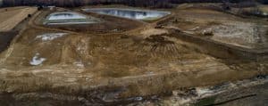
- Wastewater Treatment Plant

-
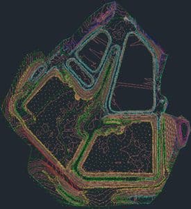
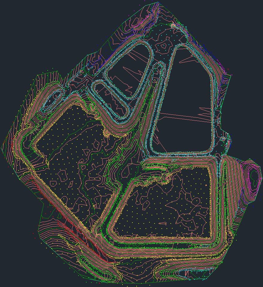
- Topographical Surface Deliverable for Wastewater Treatment Plant
-
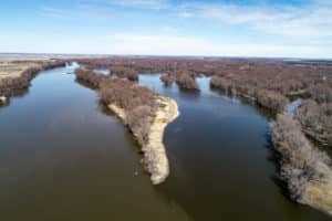
- Huron Island

-
- Topographical Surface Deliverable for Huron Island
-
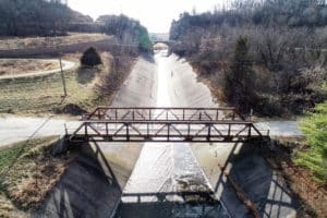
- Decorah Bridge
-
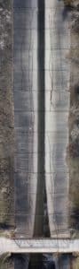
- Decorah Oneota Drive Flume Cracking

If you have questions about McClure’s UAV surveying services, please contact Kyle Younkin at 515-964-1229 or kyounkin@mecresults.com.


")


